

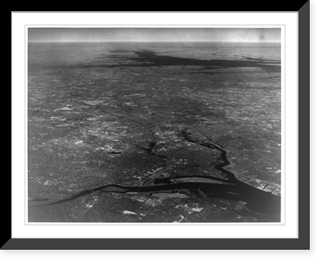
Aerial view from an altitude of 26,000 ft. (5 miles) by use of infrared photography, showing portions of Virginia, Maryland, Pennsylvania, Delaware, New Jersey and the entire District of Columbia
Snapshots of the Past
Write a Review
Snapshots of the Past
Aerial view from an altitude of 26,000 ft. (5 miles) by use of infrared photography, showing portions of Virginia, Maryland, Pennsylvania, Delaware, New Jersey and the entire District of Columbia
- SKU:
- AMZ-SOTP-HPA-164103
- All orders include free shipping
- description:
- Historic Framed Print, [Aerial view from an altitude of 26,000 ft. (5 miles) by use of infrared photography, showing portions of Virginia, Maryland, Pennsylvania, Delaware, New Jersey and the entire District of Columbia], 17-7/8" x 21-7/8", Image:
Drawn from the Library of Congress archive, this print depicts Aerial view from an altitude of 26,000 ft. (5 miles) by use of infrared photography, showing portions of Virginia, Maryland, Pennsylvania, Delaware, New Jersey and the entire District of Columbia. The Library holds one of the most comprehensive collections of American and international historical prints in the world.
Library of Congress record: Created ca 1940 Photograph by Army Air Corps. Aerial photographs 1940-1950.Infrared photographs 1940-1950.
Choose the ready-to-hang framed version or the unframed print for custom presentation. A thoughtful gift for anyone who loves history and art. Free shipping on all US orders (domestic 48 states). Snapshots of the Past, founded in 2001, has served tens of thousands of customers worldwide.
Related Products