
Boston
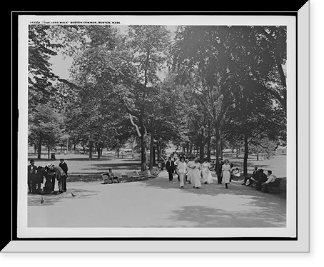
A good deal of Boston is not natural ground. The Back Bay was a tidal marsh until 1857, when the city began filling it with gravel brought by train from Needham — a trainload every forty-five minutes, day and night, for more than thirty years. The result is the only large-scale grid in a city otherwise famous for having none.
Photographs from the filling years are worth finding. They show a half-built neighborhood with water still at the end of the street, and Commonwealth Avenue laid out across mud.
Boston Common is the oldest public park in the country, set aside in 1634 as common grazing and militia ground. It was still being used for both within living memory of the earliest photographs. Cows were banned in 1830, which is later than most people guess.
Faneuil Hall and the Old State House appear constantly, and by the time of these photographs they were already being treated as relics — Boston had begun preserving its Revolutionary buildings while other cities were still knocking theirs down. That instinct is why so much of it survives.
The Great Fire of 1872 took sixty-five acres of the downtown business district. It is less famous than Chicago's the year before but the photographs are similar: masonry shells, crowds, and a rebuilding that came fast.
Fenway Park opened in 1912, the same week the Titanic sank, which is why the coverage was thin. The left field wall was built tall because the lot was small, not for any romantic reason; the nickname came decades later.
The harbor runs through everything. Boston was still a working port throughout this period, with wharves, packet ships and later steamers, and the waterfront photographs show a commercial edge to the city that the Beacon Hill images do not.
Massachusetts is also one of the deepest states in the panoramic collection — one hundred and four bird's-eye view maps and one hundred and thirty-three panoramic photographs, covering towns far beyond Boston itself.
The City That Photographed the Century It Built


-

 Snapshots of the Past
Historic Photo Print - Duluth, Minnesota - Unloading coal at Boston
Drawn from the Library of Congress archive, this print depicts Unloading coal at Boston Coal docks, Duluth, Minn. Classic. The Library holds one of the most comprehensive collections of American and...$57.00 -
 Snapshots of the Past
Vintage Photo Print - Boston - The great fire Nov. 9th, 1872
Step back in time with this striking reproduction of The great Boston fire Nov. 9th 1872. Loss about $150,000,000 Classic. Sourced from the United States Library of Congress.Library of Congress...$57.00 -
 Snapshots of the Past
Vintage Photo Print - Boston - Women working at machines
Originally preserved in the Library of Congress, this print of Women working at machines, beaming and inspecting yarn, American Woolen Company, Boston is now available for your home or office. The...$57.00 -
 Snapshots of the Past
Antique Scenic Print - Boston - Fenwick Island Shoal light vessel.N.L
Originally preserved in the Library of Congress, this print of Fenwick Island Shoal light vessel.N.L. Stebbins, Photo, Boston is now available for your home or office. The Library has preserved this...$57.00 -
 Snapshots of the Past
Historic Architecture - Boston, Massachusetts - Bunker Hill Monument
Step back in time with this striking reproduction of Bunker Hill Monument, Boston, Mass. Sourced from the United States Library of Congress.Library of Congress record: Created between 1860 and 1865...$57.00 -
 Snapshots of the Past
Vintage Photo Print - Boston - The balance of trade with Great Britain
Originally preserved in the Library of Congress, this print of The balance of trade with Great Britain seems to be still against us. 650 paupers arrived at Boston in the steamship Nestoria, April...$57.00 -
 Snapshots of the Past
Historic Photo Print - Boston - 1981 Marathon.KN Martin (1)
Step back in time with this striking reproduction of 1981 Boston Marathon.KN Martin. Sourced from the United States Library of Congress.Library of Congress record: Created New Orleans, La : Pro...$57.00 -
 Snapshots of the Past
Vintage Building Photo - Boston - Camp of the 37th Mass. Vol's
Step back in time with this striking reproduction of Camp of the 37th Mass. Vol's. near Brandy Station, Va..Bakers; J.H. Bufford's lith., Boston. Sourced from the United States Library of Congress...$57.00 -
 Snapshots of the Past
Antique Architecture - Boston - Church (New South Church)
This rare historical print captures Church (New South Church"), Summer Street and Bedford Street, Boston, Massachusetts. Interior perspective" - 3 Classic in remarkable detail. Sourced directly from...$57.00 -
 Snapshots of the Past
Historic Photo Print - Boston - misses point after touchdown
This rare historical print captures Boston misses point after touchdown in remarkable detail. Sourced directly from the Library of Congress, it represents an authentic piece of documented history...$57.00 -
 Snapshots of the Past
Vintage Building Photo - Boston - Surprise - built at East, 1850
Step back in time with this striking reproduction of Surprise" - built at East Boston in 1850 by Samuel Hall". Sourced from the United States Library of Congress.Library of Congress record: Created...$57.00 -
 Snapshots of the Past
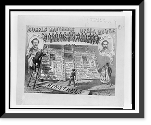
Vintage Building Photo - Boston - Morris Brothers' opera house
Drawn from the Library of Congress archive, this print depicts Morris Brothers' opera house, Boston.A. Trochsler & Co. lith., Boston. The Library holds one of the most comprehensive collections of...$57.00