
Charleston
The Civil War began in Charleston harbor at half past four in the morning on 12 April 1861, when batteries around the harbor opened on Fort Sumter. The fort surrendered after thirty-four hours with nobody killed in the bombardment — the only death came afterward, during the surrender salute, when a gun burst.
Sumter was then held by the Confederacy for nearly four years and shelled continuously by Union guns. Photographs from 1865 show it reduced from a three-tier masonry fort to a low mound of rubble and sandbags. It is one of the most photographed structures of the war and the images are genuinely shocking in sequence.
The city itself was shelled too, from Morris Island, for nearly two years. The lower peninsula was abandoned. Photographs from the end of the war show a district of ruined houses that a great many people at the time read as judgment.
Then, on 31 August 1886, an earthquake estimated around magnitude seven struck near Charleston — the most damaging earthquake ever recorded in the eastern United States. It killed roughly sixty people and damaged most of the buildings in the city. It was felt in Boston and Chicago.
The photographs of the aftermath are the reason so much survives today: the repairs used long iron rods driven through the buildings and bolted at each end with earthquake bolts, which are the round and cross-shaped plates visible on hundreds of Charleston facades. Almost every one dates from that year.
Rainbow Row on East Bay Street was a run of merchants' houses with the shops below and living quarters above. The colors are a twentieth-century restoration; the photographs from the 1890s show them in poor repair and largely unpainted.
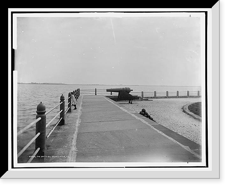
The Battery faces the harbor with the antebellum houses behind it, and it is where most of the city's tourist photography was made from the 1880s onward.
The City the River Made and Kept Threatening to Take






-

 Snapshots of the Past
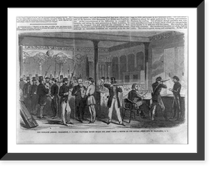
Vintage Military Print - Charleston - The Ordnance armory
Step back in time with this striking reproduction of The Ordnance armory, Charleston, S.C. - the volunteer troops trying the arms - from a sketch by our special artist now in Charleston, S.C. Sourced...$57.00 -
 Snapshots of the Past
Vintage Nautical Print - Charleston - On deck of the U.S.S. Pawnee
This rare historical print captures On deck of the U.S.S. Pawnee. off Charleston, S.C in remarkable detail. Sourced directly from the Library of Congress, it represents an authentic piece of...$57.00 -
 Snapshots of the Past
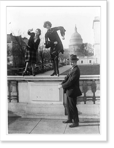
Historic Architecture - Charleston - at the Capitol
This rare historical print captures Charleston at the Capitol Classic in remarkable detail. Sourced directly from the Library of Congress, it represents an authentic piece of documented history...$57.00 -
 Snapshots of the Past
Vintage Building Photo - Charleston - Grave of John C. Calhoun
Originally preserved in the Library of Congress, this print of Grave of John C. Calhoun, in front of St. Philip's Church, Charleston, S.C is now available for your home or office. The Library has...$57.00 -
 Snapshots of the Past
Vintage Building Photo - Charleston - House where the Union officers
This rare historical print captures House where the Union officers were confined under fire, Broad Street, Charleston, S.C in remarkable detail. Sourced directly from the Library of Congress, it...$57.00 -
 Snapshots of the Past
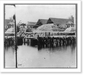
Antique Maritime - Charleston - Battery. Three gun battery
Originally preserved in the Library of Congress, this print of Boys working in Amoskeag Mfg. Co., Manchester, N.H. Largest one is Ernest Lamontague, 316 Notre Dame Street. Smallest, Armedos Deshais,...$57.00 -
 Snapshots of the Past
Antique Architecture - Charleston - Vendue Range, S.C. The building
Step back in time with this striking reproduction of Vendue Range, Charleston, S.C.. The building on the left is where the first shell struck the city. Sourced from the United States Library of...$57.00 -
 Snapshots of the Past
Black & White Photo - Charleston - South Carolina: The orphan asylum
Originally preserved in the Library of Congress, this print of Charleston, South Carolina: The orphan asylum, facade is now available for your home or office. The Library has preserved this image as...$57.00 -
 Snapshots of the Past
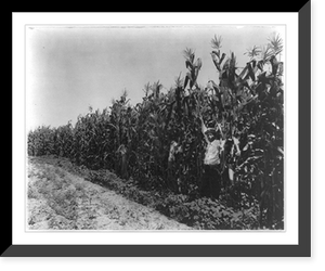
Black & White Photo - Mississippi - A corn crop on Lamb-Fish Lumber
Step back in time with this striking reproduction of A corn crop on Lamb-Fish Lumber Company's plantation near Charleston, Miss. Sourced from the United States Library of Congress.Library of Congress...$57.00 -
 Snapshots of the Past
Antique Photo Print - Charleston - Springtime
This rare historical print captures Springtime in Charleston in remarkable detail. Sourced directly from the Library of Congress, it represents an authentic piece of documented history.Library of...$57.00 -
 Snapshots of the Past
Antique Photo Print - Charleston - St. Philip's in the rain
Drawn from the Library of Congress archive, this print depicts St. Philip's in the rain, Charleston. The Library holds one of the most comprehensive collections of American and international...$57.00 -
 Snapshots of the Past
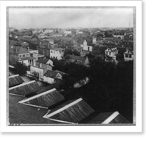
Antique Bird's Eye View - Charleston - Bird's-eye view of South Carolina
This rare historical print captures Bird's-eye view of Charleston, South Carolina in remarkable detail. Sourced directly from the Library of Congress, it represents an authentic piece of documented...$57.00