
Historic American Buildings Survey

The Historic American Buildings Survey began in 1933 as a make-work program for unemployed architects, and it turned into the most systematic architectural record any country has ever made of itself.
The idea came from Charles Peterson, a young National Park Service architect who proposed putting a thousand out-of-work draftsmen to the task of documenting American buildings before they disappeared. The Depression had put architects out of work and had also, by stopping construction, made it a good moment to look at what already stood. The program was approved in weeks.
The method is what makes the material valuable. A HABS record is not a snapshot. It is a set of measured drawings made to archival standards, large-format photographs shot with a view camera on a tripod, and written historical documentation — all three, filed together, for a single building. The photographs are deliberately plain: straight-on, evenly lit, no atmosphere, because the purpose was record rather than art.
That plainness is the point. A HABS photograph of a doorway shows you the doorway. Every molding profile, every hinge, every course of brick. If the building burned the following year, and many did, the record is complete enough to rebuild from.
The photographers worked under an unusual instruction: record, do not interpret. No dramatic angles, no atmospheric light, nothing that would flatter the building or the picture. That discipline is why the results are still usable ninety years later, when a more artful survey would look dated.
The range is enormous and it is not confined to grand houses. Mills, barns, slave quarters, privies, lighthouses, covered bridges, storefronts, courthouses, tenements, sawmills and outbuildings all got the same treatment as the mansions. That was a deliberate decision and an unusual one for its time — the survey took the position that ordinary buildings were also history.
The drawings deserve as much attention as the photographs and get far less. A HABS sheet is drawn in ink on archival linen or mylar to a standard that has not changed in ninety years — plans, elevations, sections and details, at stated scale, with a title block. They were made by hand by draftsmen who had trained as architects, and a good sheet is a beautiful object in its own right.
The photographers were professionals hired for the work, and the best of them are worth knowing by name. Their negatives run to eight by ten inches, which is why a HABS image holds detail at any enlargement.
The survey never stopped. It has run continuously since 1933 apart from a wartime pause, and the collection now covers tens of thousands of structures. A great many of them no longer exist, which was always the expectation.
The Historic American Engineering Record was added in 1969 and works the same way for bridges, dams, factories, canals and machinery. The two collections sit together and it is worth searching both — a great deal of industrial America was documented under the engineering record rather than the buildings survey.
For captions, the HABS naming convention gives you the building, the street address, the city, the county and the state, in that order. It is verbose but it is precise, and it means you can find the site on a map.
The Photographers Who Followed the Armies




-

 Snapshots of the Past
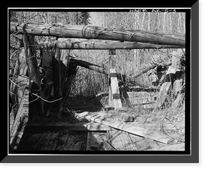
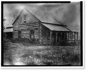
Antique Architecture - Dalton Trail Post, Mile 40, Haines Highway (3)
Drawn from the Library of Congress archive, this print depicts Dalton Trail Post, Mile 40, Haines Highway, Haines vicinity, Aleutian Islands, AK - 21. The Library holds one of the most comprehensive...$57.00 -
 Snapshots of the Past
Antique Architecture - Dalton Trail Post, Mile 40, Haines Highway (2)
This rare historical print captures Dalton Trail Post, Mile 40, Haines Highway, Haines vicinity, Aleutian Islands, AK - 4 Classic in remarkable detail. Sourced directly from the Library of Congress,...$57.00 -
 Snapshots of the Past
Antique Architecture - Dalton Trail Post, Mile 40, Haines Highway (1)
Originally preserved in the Library of Congress, this print of Dalton Trail Post, Mile 40, Haines Highway, Haines vicinity, Aleutian Islands, AK - 3 is now available for your home or office. The...$57.00 -
 Snapshots of the Past
Historic Architecture - Ladd Field, Radio Station, Fort Wainwright
Step back in time with this striking reproduction of Ladd Field, Radio Station, Fort Wainwright, Fairbanks, Fairbanks North Star Borough, AK. Sourced from the United States Library of Congress...$57.00 -
 Snapshots of the Past
Antique Architecture - Davidson Ditch Waste Water Weir
Originally preserved in the Library of Congress, this print of Davidson Ditch Waste Water Weir, Mile 63 of Alaska's Steese Highway, Chatanika vicinity, Fairbanks North Star Borough, AK - 3 Classic is...$57.00 -
 Snapshots of the Past
Vintage Building Photo - Mount McKinley Headquarters, Boiler House
Historic Framed Print, Mount McKinley Headquarters, Boiler House, McKinley Station, AK, 17-7/8" x 21-7/8", Image: 16" x 20"Beautiful historic reproduction print from the Library of Congress...$57.00 -
 Snapshots of the Past
Vintage Building Photo - Mount McKinley Headquarters
This rare historical print captures Mount McKinley Headquarters, Dog Feed Cache & Sled Storage, McKinley Station, AK - 3 Classic in remarkable detail. Sourced directly from the Library of Congress,...$57.00 -
 Snapshots of the Past
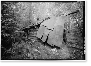
Antique Architecture - George McGregor Cabin - Vintage Wall Art Gift
Drawn from the Library of Congress archive, this print depicts George McGregor Cabin, Yukon River near Coal Creek, Circle vicinity, Yukon-Koyukuk Census Area, AK - 3. The Library holds one of the...$57.00 -
 Snapshots of the Past
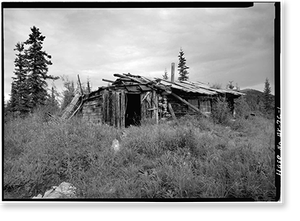
Historic Architecture - A. D. Wilcox Drift Mine, Residential Cabin
This rare historical print captures A. D. Wilcox Drift Mine, Residential Cabin, Linda Creek near Dalton Highway, Bettles vicinity, Yukon-Koyukuk Census Area, AK in remarkable detail. Sourced directly...$57.00 -
 Snapshots of the Past
Antique Architecture - A. D. Wilcox Drift Mine, Boiler Cabin
Originally preserved in the Library of Congress, this print of A. D. Wilcox Drift Mine, Boiler Cabin, Linda Creek near Dalton Highway, Bettles vicinity, Yukon-Koyukuk Census Area, AK is now available...$57.00 -
 Snapshots of the Past
Historic Architecture - Green Butte Copper Company
Drawn from the Library of Congress archive, this print depicts Green Butte Copper Company, Bunkhouse (Upper camp), McCarthy Creek 12 miles Northeast of McCarthy, McCarthy vicinity, Valdez-Cordova...$57.00 -
 Snapshots of the Past
Antique Architecture - Green Butte Copper Company, Portal Shed
Originally preserved in the Library of Congress, this print of Green Butte Copper Company, Portal Shed, McCarthy Creek 12 miles Northeast of McCarthy, McCarthy vicinity, Valdez-Cordova Census Area,...$57.00